Thematic walking tours

learning by walking

In the commune of Wellin

Discovering the Calestienne

Departure point: car park in front of the church – 6920 Froidlieu
The commune of Wellin is located in the heart of the Calestienne, a limestone strip that stretches from Chimay to Remouchamps. Bordered to the north by the Famenne and to the south by the Ardennes massif, the landscapes that can be discovered here reflect the nature of the subsoil. Discover this region whose high landscape value of limestone formations, linked to the richness of the vegetation, has given it worldwide recognition under the Famenne-Ardenne Geopark label awarded by UNESCO in 2018.
This educational walk takes you over a distance of 7.6 km.


The Flower Walk

Departure: village of Sohier – 6920 Wellin
This 5 km circuit invites you to discover one of the Most Beautiful Villages of Wallonia and its surroundings full of flowers during the whole summer period.
The map (available at the Office du Tourisme of Wellin) shows more than 30 points of interest in terms of heritage, landscape or specific to the various flower plantations.

Discovering the subnatural forest

Departure point: Maria footbridge, Rue Napoléon Bonaparte – 6822 Halma
Discover a surprising route and discover the riches of an exceptional ancestral heritage. This 4 km hilly walk takes you through a forest that is over 250 years old. You will appreciate the power and majesty of these trees that have survived the centuries.

On the borders of the Calestienne and the Ardennes

Departure point: car park of the local library Rue de Beauraing 173 – 6920 Wellin
This 9.5 km walk, which is not signposted, is entirely through the detrital rocks of the Ardennes, but it offers a beautiful panorama of the Calestienne from the viewpoint of Sohier. Wellin is a town with a long history. A series of archaeological excavations have shed some light on its origins. The town was named after a Frankish landowner, Wadalinus. Thanks to the various excavations, which revealed rich tombs from the 6th century, it was determined that the town dates back to at least this period. The excavations also provided evidence of some form of settlement, with 80 wooden post holes. Wellin was therefore the centre of a large Merovingian domain. The map and roadbook for this geobalad are available at the Office du Tourisme of Wellin.

The Lomprez wetland and its educational walk

Start: rue du Mont – 6924 Lomprez
Discover this marsh area, its biodiversity facilities such as the insect hotel or the swallow nests. The walk lasts about 30 minutes and is enhanced by educational panels.

Office du tourisme communal de Wellin

Grand Place 2 – 6920 wellin
+32 84 41 33 59

tourisme@wellin.be

In the commune of Tenneville

Across the fields

Departure point: Erneuville church car park – 6972 Tenneville
This 13 km route takes you to Belle-Vue, Wyompont and Cens, following the route of two “ancestors” of the Nationale 4: the ancient Roman road Metz-Tongres and the Marie-Thérèse road. The description of the walk is included in the topoguide “A travers champs” published in the collection “Tenneville Découvertes”. You will also find observations of the heritage, whether built, natural or landscape, as well as anecdotes from the past. A 9 km variant allows you to shorten the walk via the village of Wembay.

The Circuit of "la Ferme des Frênes"

Departure: Chemin de Mousny 14 – 6970 Tenneville
Thanks to this educational walk starting from the Ferme des Frênes, learn to understand the assets of agricultural landscapes.
This brand new 5.3 km signposted route, which is due to be set up this year, will take you on a journey of discovery while enjoying superb views of the region.

Syndicat d’initiative Champlon-Tenneville
B-6971 tenneville
+32 84 45 54 26
tourisme@champlon.info

In the commune of Tellin

The story of the 4 so-called witches

Departure: Place de l’Yser – 6927 Grupont
The fight against witchcraft is a dark part of Ardennes history. This new 8 km educational trail takes you on the trail of Jehenne, Marie, Jejenne and Alix Jamin. It also takes you to magnificent viewpoints over the Famenne and the Ardennes. Who were these four women? Four sisters whose greatest misfortune was to be born at the beginning of the 17th century, during a period of witch-hunting…
The map of this unmarked itinerary is available at the Office du Tourisme de Tellin.


Meeting the hermit of Resteigne

Departure point : car park at chemin des chéfiris – 6927 Resteigne
This 9 km unmarked walking trail offers a splendid route between the villages of Resteigne and Belvaux through the valley of La Lesse and the Bois de Niau. It takes equal parts footpaths and small roads, sometimes with a certain difference in height, such as the climb to the Hermitage (100 m). From a geological point of view, it highlights one of the characteristic elements of the geopark, the Devonian limestone.
The map and roadbook of this geobalad (FR/NL) are available at www.geoparkfamenneardenne.be and at the Office du Tourisme.

The Chapel Walk

Departure: Church of Bure – 6927 Tellin
The chapel walk is a 4 km long, signposted route. It passes by the chapel of Notre-Dame de Haurt and its magnificent avenue of linden trees. Take a break in front of the chapel to admire the landscape.

Office du Tourisme communal de tellin
+32 84 36 60 07
tourisme@tellin.be

In the commune of Saint-Hubert

The didactic walk of the Marsoult

Departure point: rue du Moulin 16 – 6870 Saint-Hubert
The walk of Marsoult starts at the fish farm of the Provincial Domain of Mirwart and is 5 km long. This walk, on flat ground, around the ponds is ideal for families with children. The 7 didactic panels that are placed along the route will introduce you to biodiversity, predatory fish, trees or charcoal burners.

The clog makers' circuit

Departure: Village of Awenne – 6870 Saint-Hubert
In the middle of the 19th century Awenne became the centre of a dynamic and prosperous clog industry. This industry, which originated in Laneuville-au-Bois, developed in quality and quantity in Awenne to the point where it acquired an international reputation with its workshops. Several of them still exist and give a unique character to this village.

The city walks

Departure: Place du Marché 15 – 6870 Saint-Hubert
Several downloadable walks invite you to discover the city centre of Saint-Hubert:
the Redouté circuit dedicated to the life of the famous painter Pierre-Joseph Redouté (1.3 km)
the Remembrance Trail commemorating the two World Wars in Saint-Hubert (3.5 km)
the Ringers path takes you on a discovery of rich and varied views of the city (4 km)
the Archi Hub circuit gives you the opportunity to discover the history of architecture in Saint-Hubert and the styles that have accompanied the city’s development (2 km)

Royal Syndicat d’Initiative de Saint-Hubert
+32 61 61 30 10
info@rsi-sainthubert.be

In the commune of Libramont-Chevigny

Discovering the "Fagne des anomalies"

Start: rue Au Bois la Dame (next to the little chapel) – 6800 Séviscourt
This 8.5 km walk (not signposted) takes you to discover the Fagne des Anomalies. On the spot, observe a partially wooded peat bog, low marshes rich in narrow-leaved cottongrass, an important grouping of narthecia and a pioneer association of bare peat, exceptional in Wallonia.


the 9th Art Walk

Departure point: avenue d’Houffalize 56F – 6800 Libramont
The 9th Art Walk is a 6.3 km marked out route through the forest. It is marked out with silhouettes and comic strip paintings inviting you to discover 8 people on the way.

city walks

Starting point: Office du Tourisme – Grand’Rue 24 – 6800 Libramont-Chevigny
Two downloadable walks allow you to take a different look at the city:

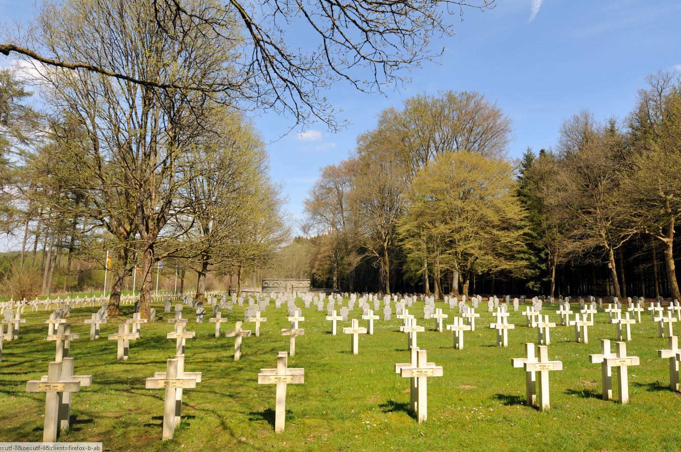
The Citizens’ Walk is a fun and interactive walk that takes you on a journey through our history but above all through citizenship: Democracy, Education, Freedom of Expression, Resistance and Remembrance (3.5 km);

The urban walk takes you through Libramont-Chevigny with various points of interest on history, heritage, architecture and legend (6.8 km).

The Celtic educational walk

Departure point: Bonance forest park (rue de Bonance) – 6800 Libramont-Chevigny
Follow Eira, the young Celtic child, and her friend Kadoc the scourge on this walk marked out by educational panels that invite you to observe the surrounding nature. They also explain how the Celts exploited their environment in surprising ways.
The walk consists of two loops: one of 1.3 km, which can be extended by a 3 km walk on forest paths.

Office du Tourisme communal de Libramont-Chevigny
+32 61 27 04 82 

tourisme@libramont.be

In the commune of Libin

On the trail of 14-18

Departure point : rue de Burnaumont – 6890 Anloy
Jalonnée d’une vingtaine de panneaux explicatifs et d’une table d’orientation, cette balade est l’occasion de découvrir l’histoire de la Première Guerre Mondiale à Anloy.
Le parcours, sans difficulté, emmène à travers les bois et le village d’Anloy, passant par différents monuments historiques. Comptez environ 2h30 de marche pour parcourir les 8 km.
Des visites guidées sont organisées sur réservation par la Fondation MERCI (info@lamerci.be).

the Space Walk

Departure: car park of the Euro Space Centre, in front of Les Hêtres 1, 6890 Transinne
During this 6.2 km long country and forest walk, immerse yourself among the leafy trees and embark on a journey into space. Sculptures made by the Atelier de Jo are set up along the route. Each one represents a person from Greek or Roman mythology, whose name has been used to characterise a field of astronomy or the conquest of space.

the poetry walk

Start: rue de Transinne, 6890 Redu

In 2024, as the village celebrates the fortieth anniversary of Redu Village du Livre, the 5th “Joie de livre” poetry walk is dedicated to celebration, imagination and joy. Equipped with your route book, available from the Libin Tourist Office, follow the 1.2 km route! At the end of the walk, it’s your turn to create… Write your own poems and put them in colour.

the nuton trail

Departure point: Route de Smuid, 6890 Libin
Following this 1.8 km long fun trail, you can walk in the footsteps of the “nutons”, the dwarfs of Ardennes legends…

Office du Tourisme communal de Libin
+32 61 65 66 99

tourisme@libin.be

Skip to content